PrairieQueens.com
Missouri
Missouri News Articles
 |
Collection of Wedding Articles, Obituaries and other news articles |
Historical School and City Photos
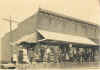 |
School photos, old city photos from Marion, Monroe and Shelby County |
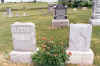
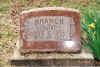
Marion County Cemeteries
 |
Andrew Chapel Cemetery,
Warren, Missouri
Alfred and Ida Phelps Branch, Sam and Della Pendleton Branch, Denton and Fairy Branch Pendleton, Leo and Effie Maiden Branch, many others. |
 |
Warren Cemetery, Warren,
Missouri
Edward Thomas Branch, wife Matilda Lilly Branch and her parents Hardy and Sarah Kestner Lilly, and his son Roy Branch. |
 |
Palmyra Cemetery, Palmyra,
Missouri
Hazel Lamont Gander, Thomas White, John D. White |
Marion County Land Patents
 |
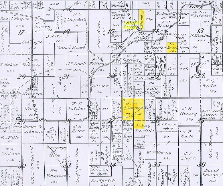
1913 era plat map of Township 58, Range 7W showing the location of several of the patents below. |
 |
David Magie land patent 9669,
November 2, 1837
South half of Section 29, Township 58 Range 7W, 320 acres This land on North River later belonged to Harvey S. Gander |
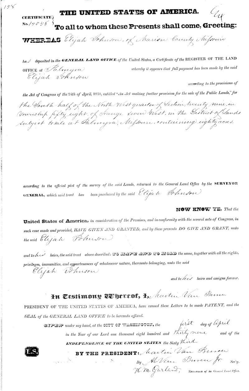 |
Elijah Johnson, Land Patent
15056, April 1, 1839
South half of the Northwest quarter Section 29, Township 58 Range 7W, 80 acres This land on North River later belonged to Harvey S. Gander |
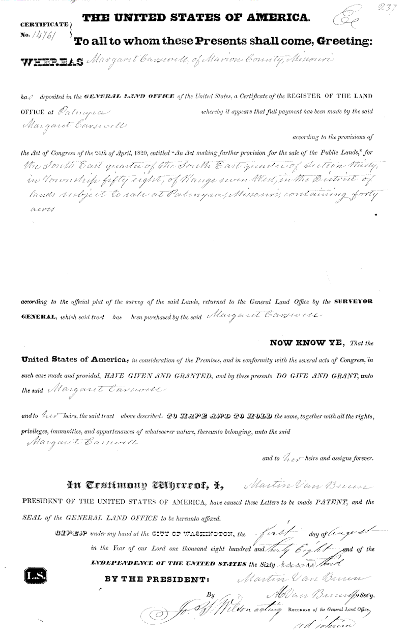 |
Margaret Carswell, Land Patent
14761, August 1, 1839
SE 1/4 of SE 1/4 Section 30, Township 58 Range 7W, 40 acres This land on North River later belonged to Harvey S. Gander |
 |
Matthew Moss, Land Patent 755,
April 1, 1829
W 1/2 of SW 1/4 of Section 10, Township 57, Range 7W, 80 acres This land is presently owned by Clifford R. Gander. It borders Sees Creek. |
|
John Moss, Land Patent Cash
entry 116, October 1, 1824
SE 1/4 of Sect 9, Township 57, Range 7W, 160 acres at $2.80 per acre for $448 total. The initial application for this land was April 13, 1819. He apparently paid $112.00 at this time and then transferred the remaining money from other land he had acquired. The second document here shows the Patent date being September 10, 1824. This land is presently owned by Clifford R. Gander. |
 |
1913 Plat map of Township 57N, Range 8W in the Warren Missouri area. |
Monroe County Land Patents and deeds
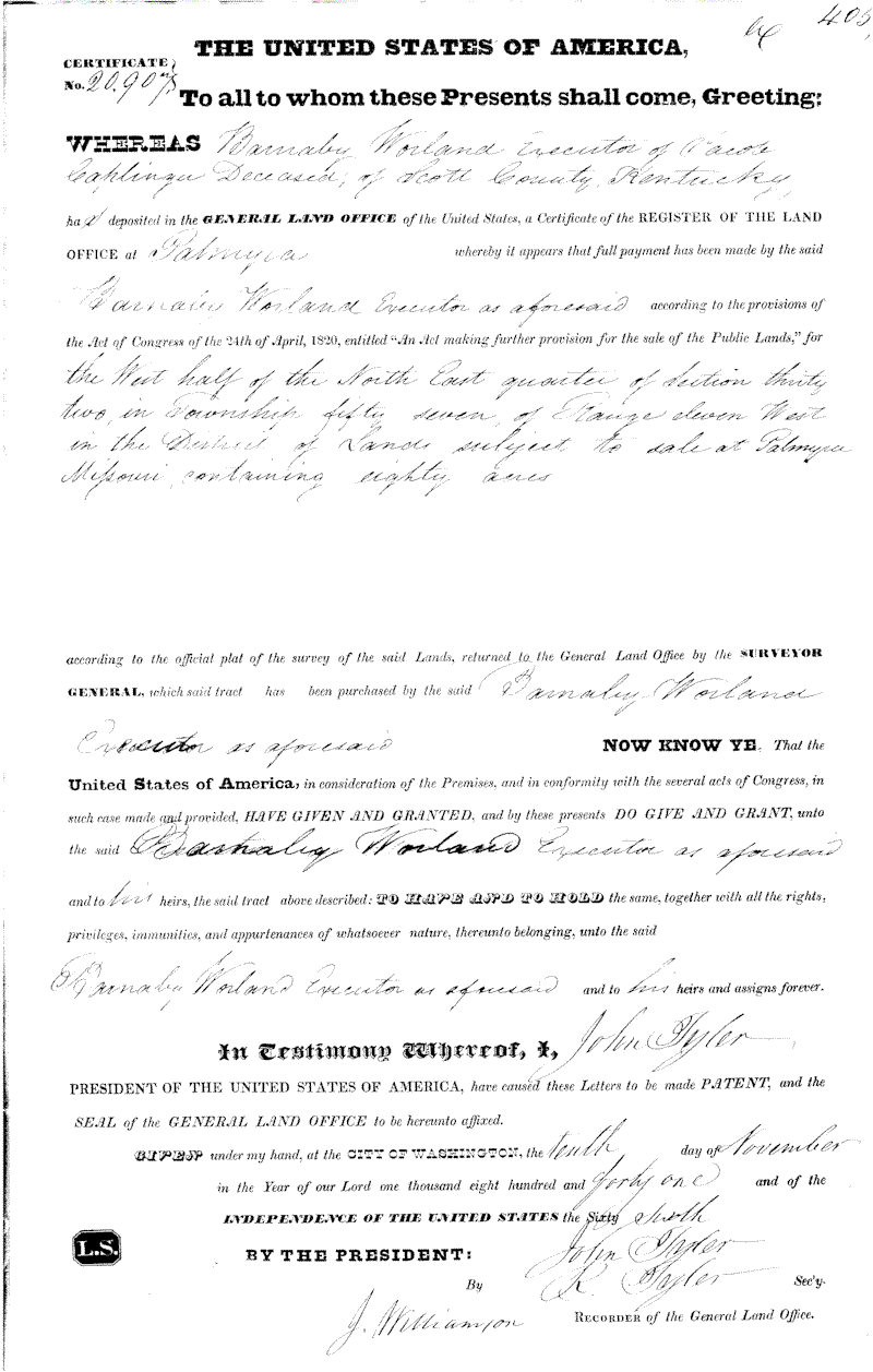 |
Barnaby Worland, executor for
Jacob Caplinger, deceased, Land Patent 20907, November 10, 1841
W 1/2 of NE 1/4 of Section 32, Township 57, Range 11W, 80 acres
|
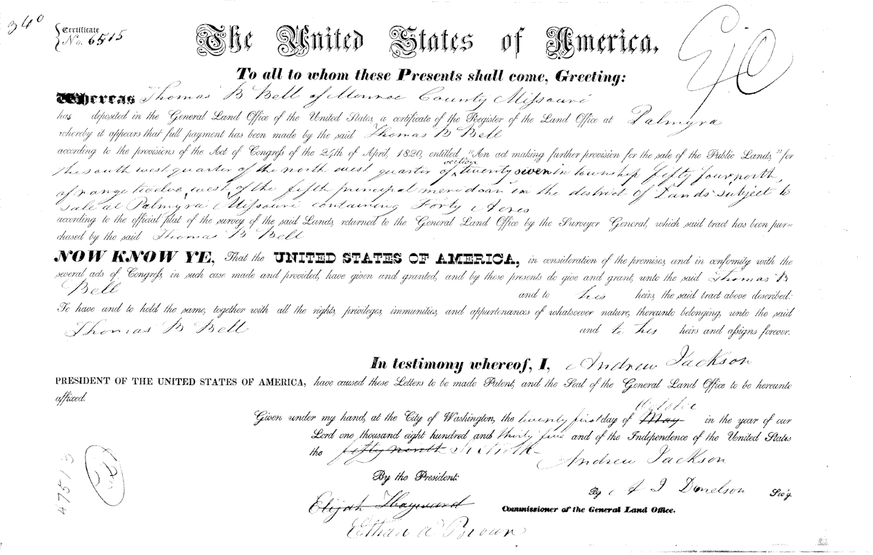 |
Thomas B Bell, Land Patent 6515,
October 21, 1835
SW 1/4 of NW 1/4 of Section 27, Township 54N, Range 12, 40 acres |
| 1839 | Barnaby Worland buys 240 Acres from George, James and Cordelia Gough
NE 1/4 of Section 32, the SE 1/4 of the NW 1/4 of Section 32, and the SW 1/4 of the SW 1/4 of Section Number 28 Township Number 56 N Range 11W |
Monroe County Cemeteries
 |
St. Jude's Cemetery, Monroe
City, Missouri
Mary Ellen Haney, Gander families |
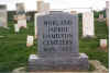 |
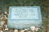
Worland/Jarboe/Hamilton
Cemetery, Lakenan, Missouri
Located on the old Worland/Jarboe home place, near Lakenan, Missouri. Many descendants of Barnaby Worland, Joseph M. Jarboe
|
 |
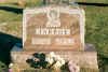
St. Peters Catholic Cemetery,
Lakenan, Missouri
Located off the road not far from the Worland/Jarboe/Hamilton Cemetery. Has many Bell, Saunders, Gough, Jarboe family members
|
Shelby County Cemeteries.
 |
St. Mary's Catholic Cemetery,
Shelbina, Missouri
James A. and Gertrude Bell Jarboe and their daughters, Gene and Ida Jarboe, Albert and Agnes Bell Kendrick, among others.
|
Ralls County Land Patents
 |
Robert Bell, Land Patent 6770,
December 15, 1835
SE 1/4 of NW 1/4 of Section 33, Township 56, Range 5W |
Shelby County Land Patents:
 |
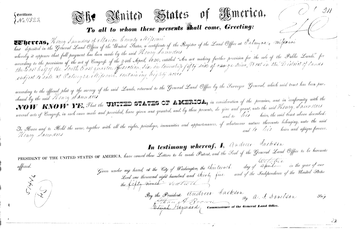
Henry Saunders, Land Patent
4321, October 13, 1835
W 1/2 of SW 1/4, Section 5, Township 56, Range 9W, 80 acres |
 |
Henry Saunders, Land Patent
4322, October 13, 1835
E 1/2 of SE 1/4, Section 6, Township 56, Range 9W, 80 acres |
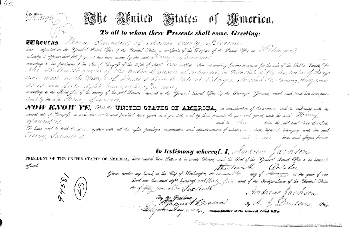 |
Henry Saunders, Land Patent
5796, October 13, 1835
SW 1/4 of NW 1/4, Section 6, Township 56N, Range 9W, 39 acres |
 |
Henry Saunders, Land Patent
6213, October 21, 1835
NW 1/4 of NW 1/4, Section 8, Township 56N, Range 9W, 40 acres |
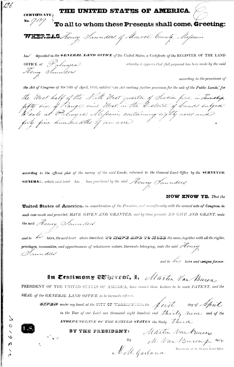 |
Henry Saunders, Land Patent
17139, April 1, 1839
West 1/2 of NW 1/4, Section 5, Township 56, Range 9W, 80 acres |
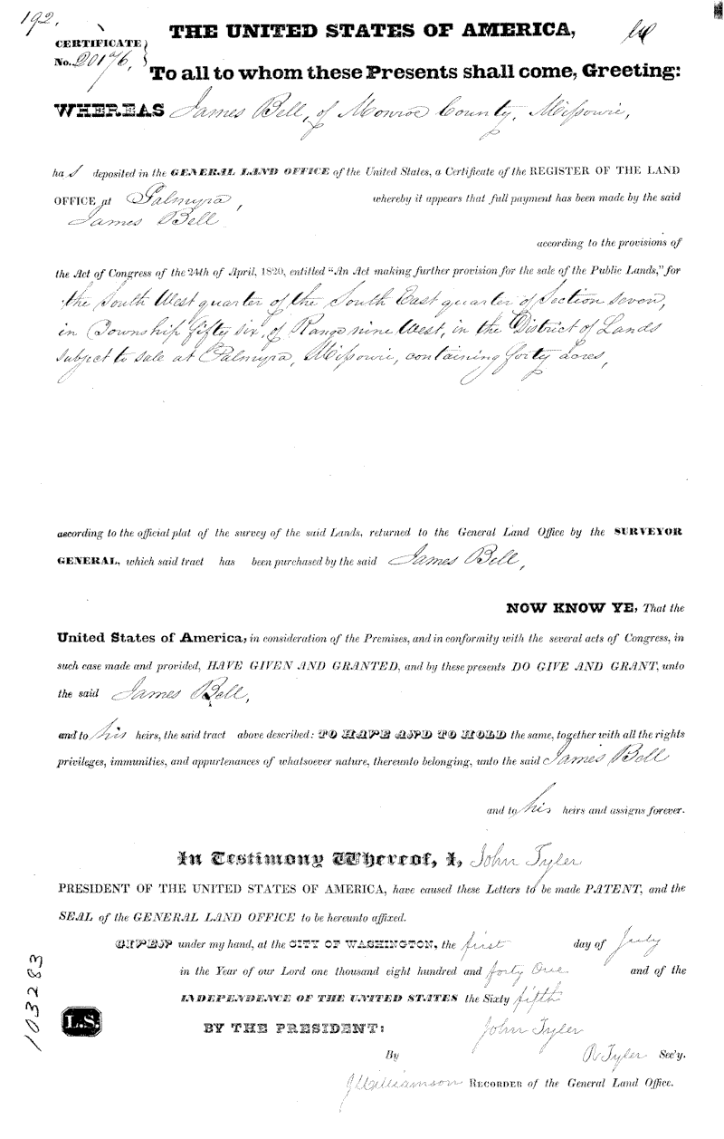 |
James Bell, Land Patent 20176,
July 1, 1841
SW 1/4 of SE 1/4, Section 7, Township 56, Range 9W, 40 acres |
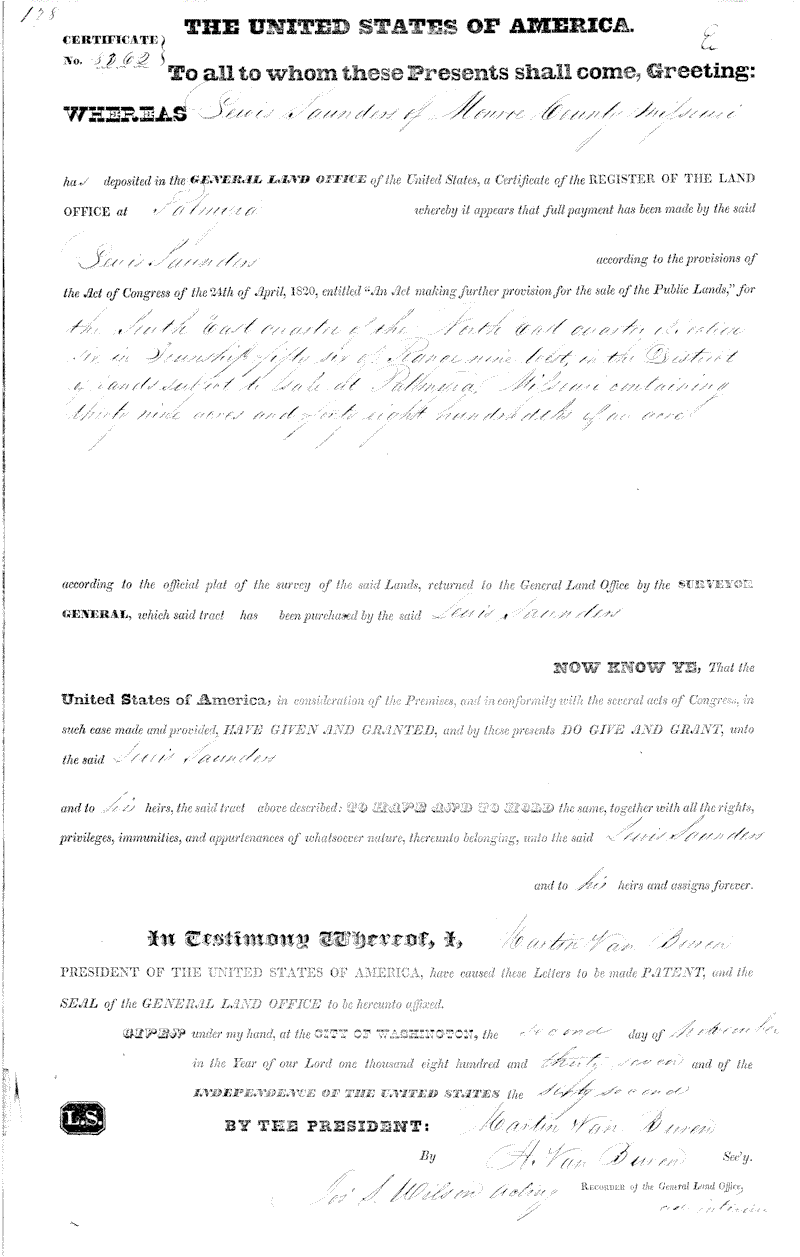 |
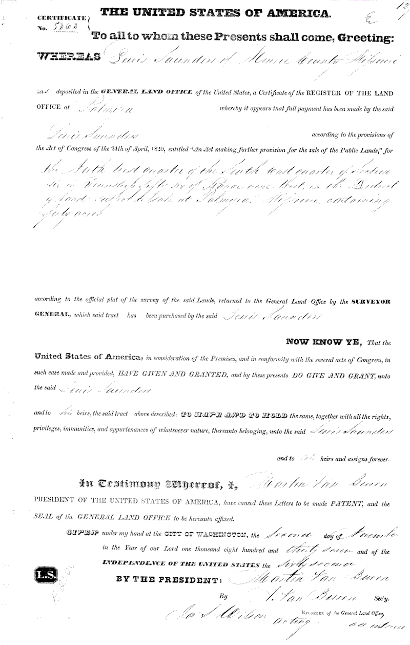
Lewis Saunders Land Patent 8362,
November 2, 1837
SW 1/4 of NE 1/4 of Section 6, Township 56, Range 9W, 39 acres |
 |
Lewis Saunders Land Patent 8362,
November 2, 1837
NW 1/4 of SE 1/4 of Section 6, Township 56, Range 9W, 39 acres
|
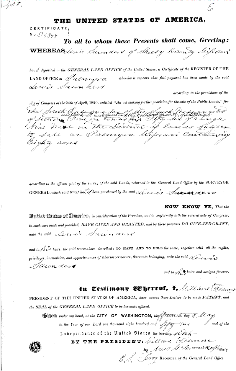 |
Lewis Saunders, Land Patent
26899, May 15, 1852
SE 1/4 of SW 1/4 of Section 5 and the SE 1/4 of NW 1/4 Section 8, Township 56, Range 9W, 80 acres |
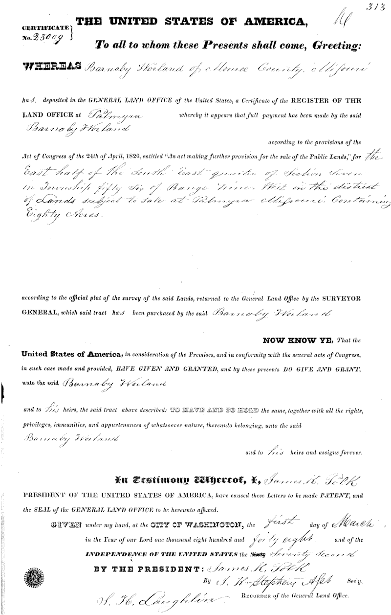 |
Barnaby Worland, Land Patent
23009, March 1, 1848
E 1/2 of SE 1/4 of Section 7, Township 56, Range 9W, 80 acres |
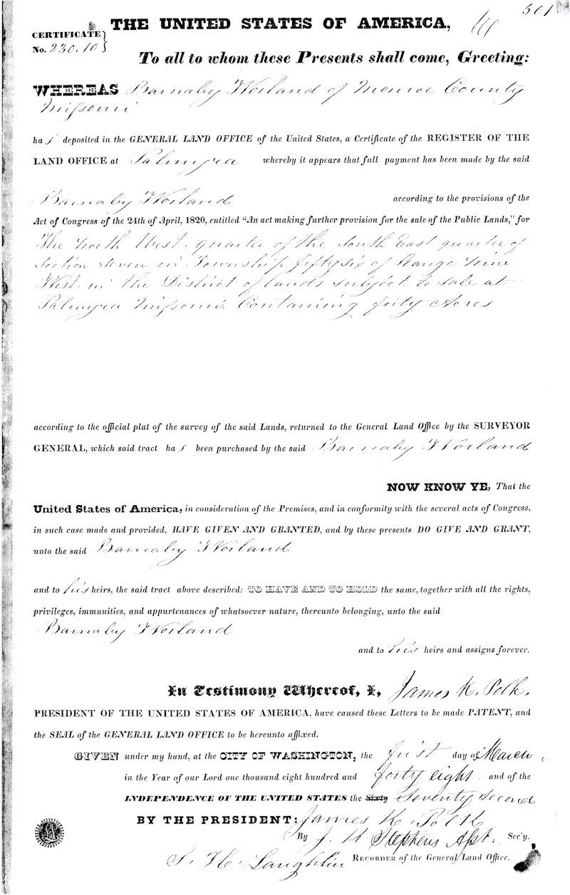 |
Barnaby Worland, Land Patent
23009, March 1, 1848
NW 1/4 of SE 1/4 of Section 7, Township 56, Range 9W, 40 acres
|
 |
Robert Bell, Land Patent 26609,
August 2, 1852
S 1/2 of SW 1/4 and SE 1/4 of SE 1/4 of Section 36, Township 57, Range 10W, 120 acres |
 |
Robert Bowling, Land Patent
18958, April 1, 1839
SE 1/4 of SW 1/4 of Section 7, Township 56, Range 9W, 39 acres |
Pike County Land Patents
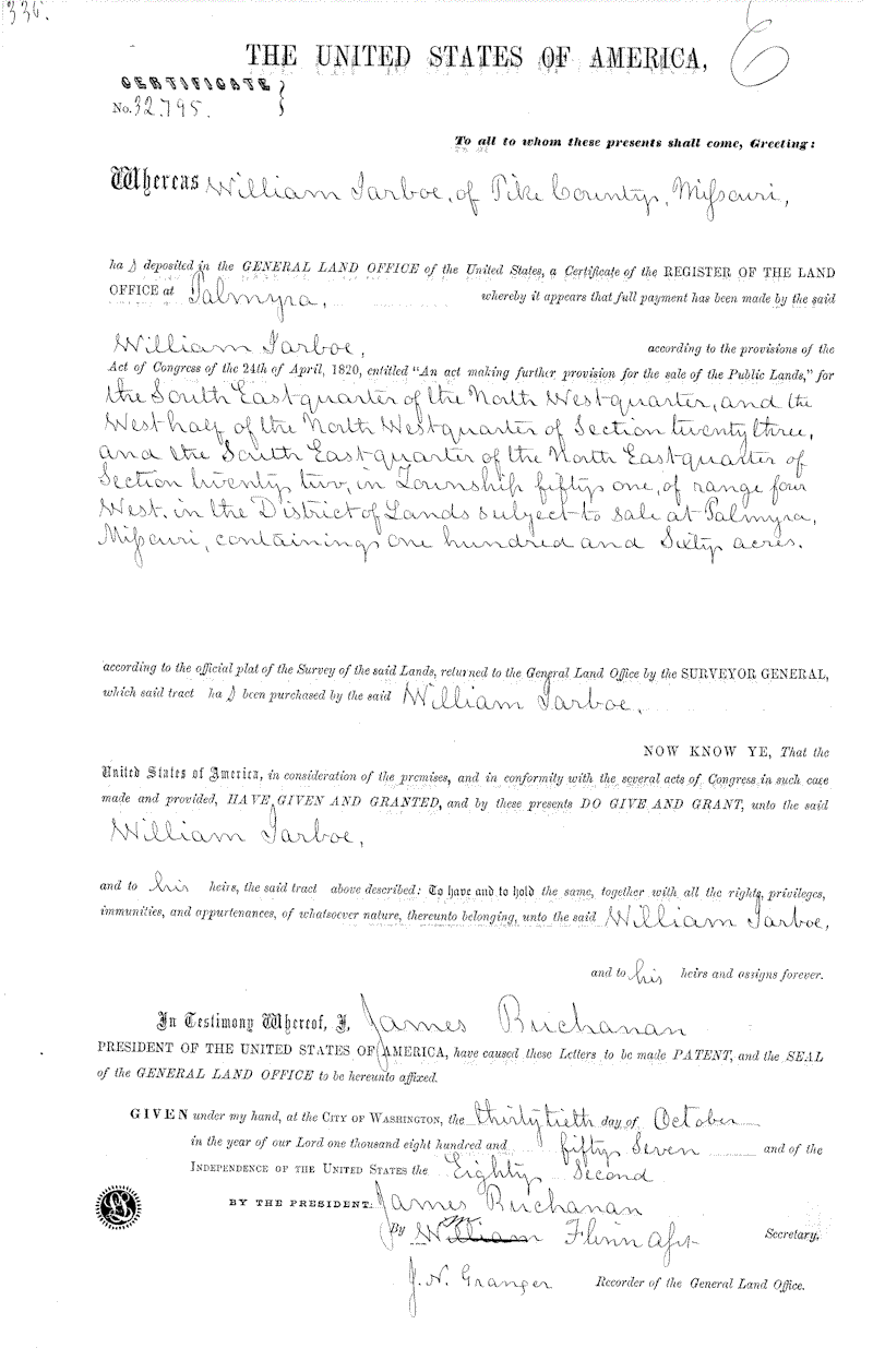 |
William Jarboe, Land Patent
32795, October 30, 1857
SE 1/4 of NW 1/2 and W 1/2 of NW 1/4 of Section 23, and SE 1/4 of NE 1/4 of Section 22, Township 51, Range 4W, 160 acres |
Greene County
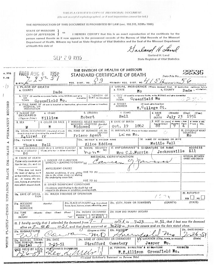 |
Death certificate for William Robert Bell, Greene County, Missouri |